



VISURABUILT FROM REALITYby Dronautix & 3DIT
Visura · Built from Reality

Visura – the browser-based 3D platform

  • GDPR & EU servers
  • Unlimited users
  • No installation
0+
Lines of source code
0+
Images processed
0+
Models generated
0+
Projects completed
Why Visura

One environment for projects, models and collaboration.

Our software connects modelling, dashboard, viewer and structured delivery. Captured data becomes a usable project environment for planning, documentation, approval and ongoing collaboration.

Built for teams who don't just want to own 3D data, but use it every day.

Model generation

Generate 3D models, point clouds, orthophotos, Gaussian splats and more directly from imagery – with your own photogrammetry pipeline, not just viewing finished files.

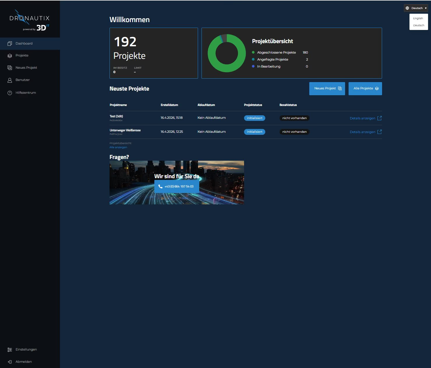
Dashboard for projects

Projects, assets and versions managed centrally – instead of scattered across folders and emails.

Browser-based viewers

Models and point clouds directly in the browser – no installation, no special software for the recipient.

Structured delivery

For teams and external partners – with clear access rights instead of uncontrolled file sharing.

How it works

Our Workflow.

From data to usable result — in three steps.

  1. 1

    Upload images, scan data or models

    Load drone images, point clouds, 3D models or orthophotos directly into the platform.

  2. 2

    Processing & delivery in the dashboard

    Automatic processing and structured delivery in your personal dashboard.

  3. 3

    Use viewers & collaborate with teams

    3D, point cloud and ortho viewers directly in the browser — measure, annotate and share.

Modules

One platform, every format.

The base module covers upload and all viewers.

Add-ons unlock processing from your own imagery.

Foundation for everything

Visura Core

  • Web platform with unlimited users
  • Upload & view every format
    • 3D models (OBJ/GLB/B3DM)
    • Point clouds (E57/LAS/LAZ/PLY)
    • Orthophotos (GeoTIFF)
  • Every viewer works instantly, no add-on required
  • Core covers upload & viewing for everything
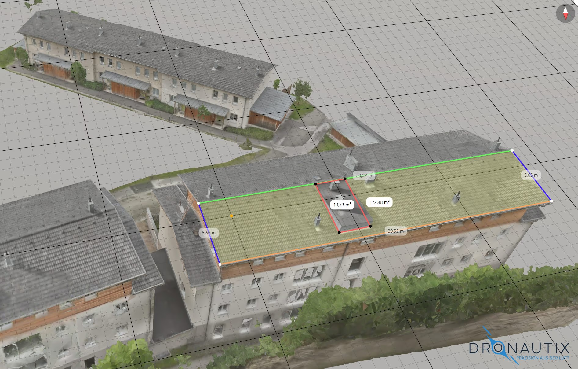
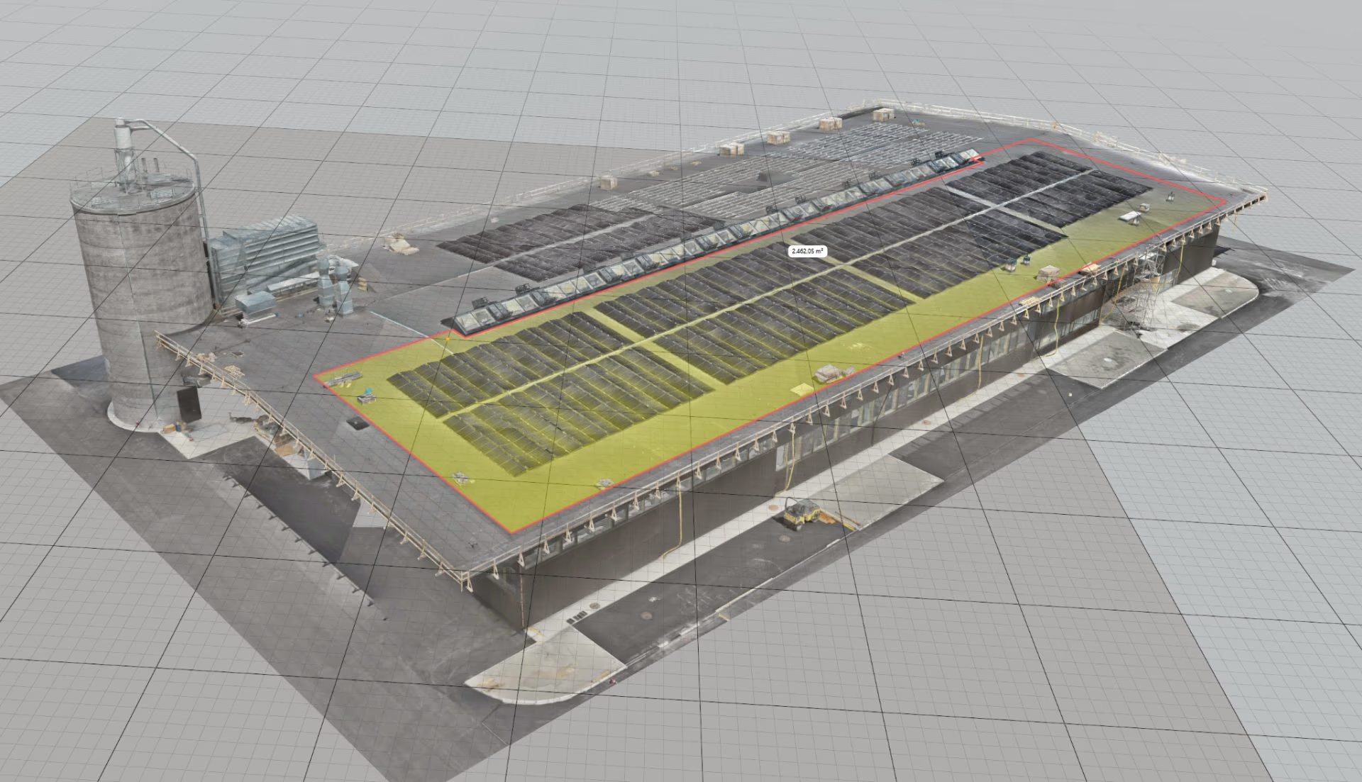
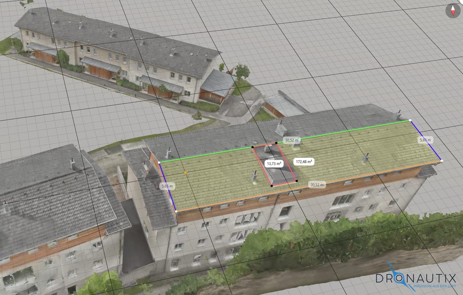
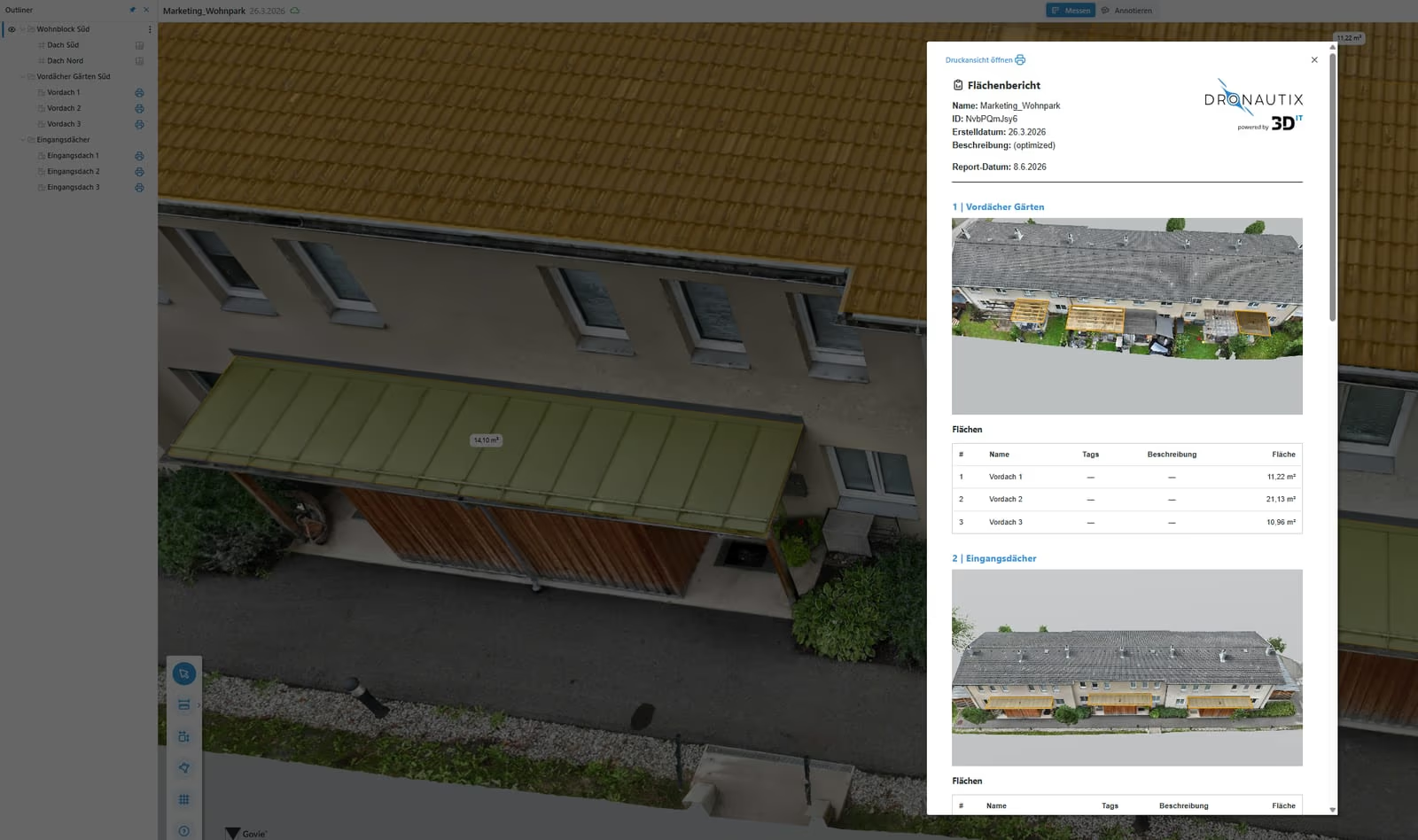
Visura 3D viewer with area measurement on a building model

3D Viewer

  • Structure distance and area measurements with the outliner
  • Layer function with naming and output of every individual length (e.g. roof eaves)
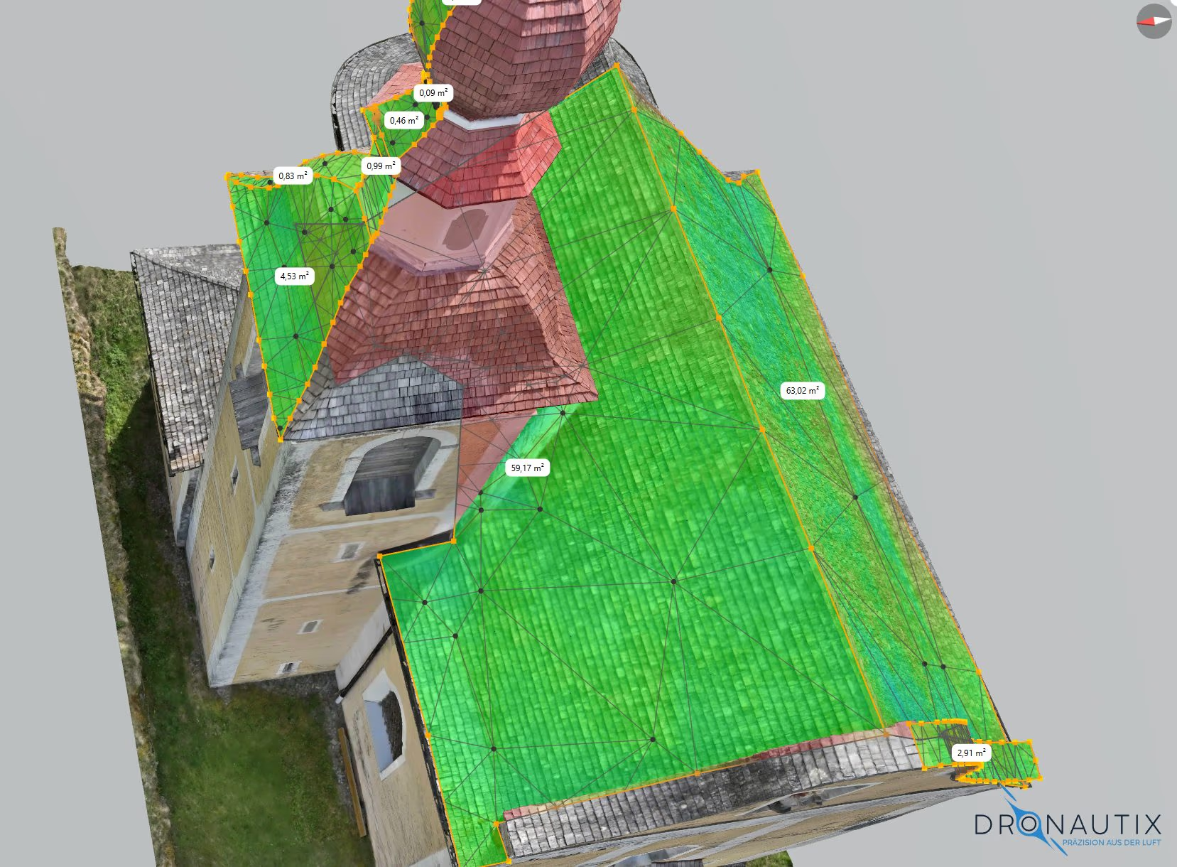
  • Convex tool for curved areas
  • Create and export area reports
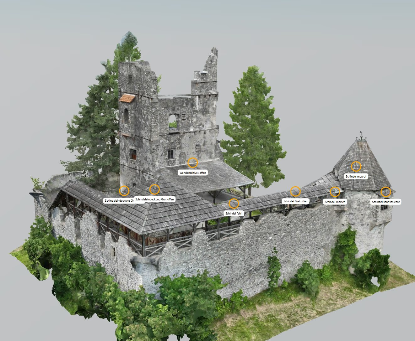
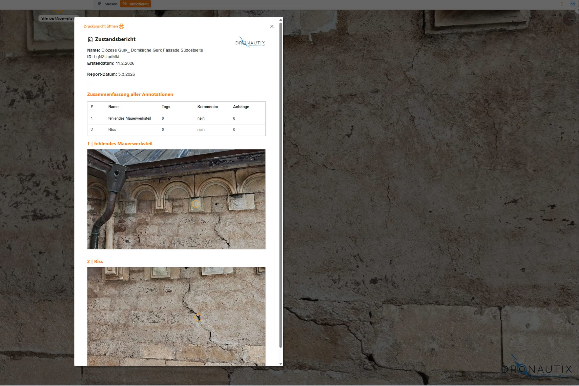
  • Annotate directly in the model and generate a condition report
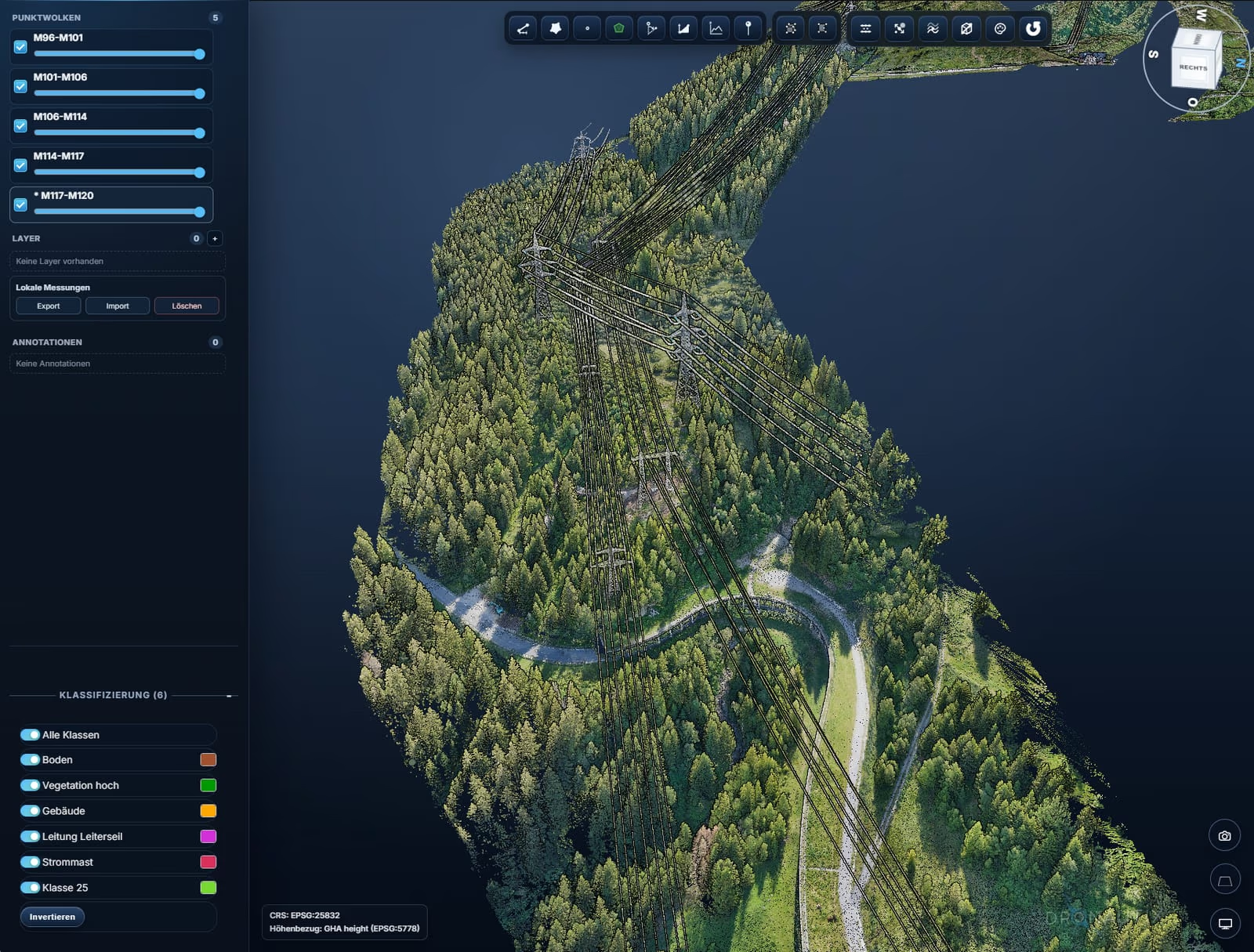
Visura point cloud viewer with a classified point cloud

Point Cloud Viewer

  • Export and import local measurements (length, area, volume, angle, height, slope)
  • Display of point cloud classes
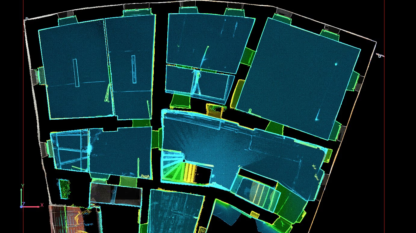
  • Create cross-sections, floor plans and elevation profiles
  • Export measurement lines as DXF
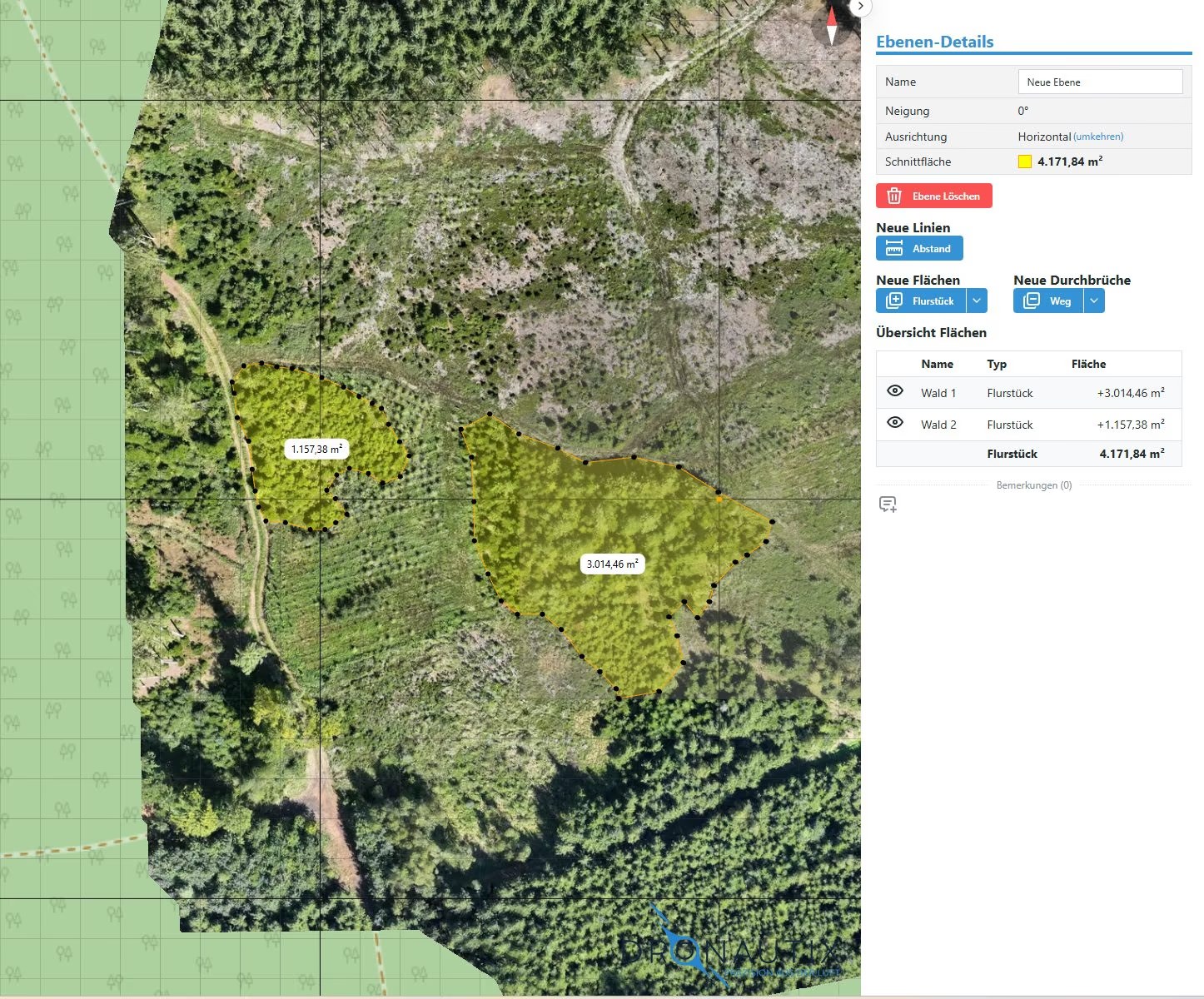
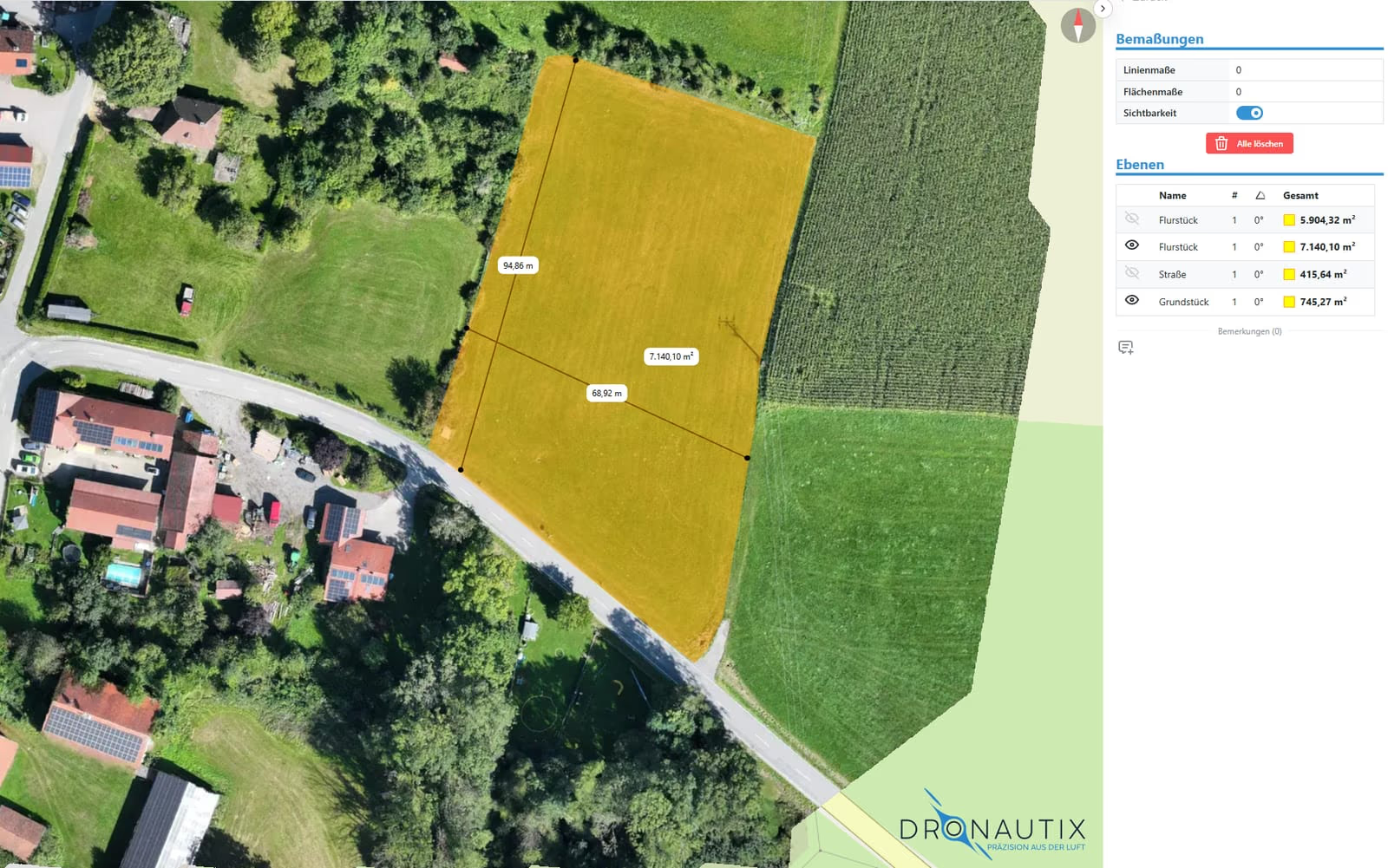
Visura ortho viewer with area measurement in an orthophoto

Ortho Viewer

  • Area and distance measurement directly in the orthophoto
  • Manage multiple layers with individual visibility and color
  • Create and export area reports
  • Map overlay directly in the model

Add-ons — processing from your own imagery

3D Model Workflow

OBJ/GLB/B3DM from imagery — downloadable and usable directly in the Core viewer.

Point Cloud Workflow

E57/LAS/LAZ/PLY from imagery — downloadable and ready for the Core viewer.

Ortho Workflow

GeoTIFF generation from imagery — ready to use in the Core viewer.

Solar Modeling

PV-Sol models, export to PV*SOL, Polysun and Helios 3D.

Gaussian Splatting

Photorealistic 3D captures, fluid in-browser navigation.

Solutions

The right tools for every industry.

Visura adapts to your jobs — not the other way around.

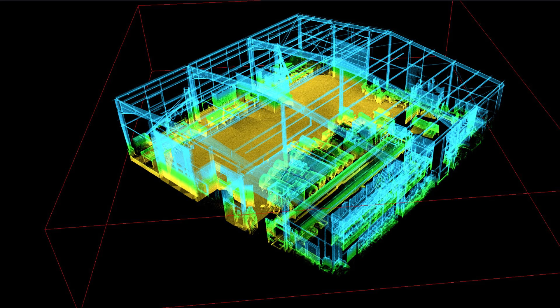
Planners and architects use Visura for as-built dataPlanning

Planners & architects

As-built data as a reliable basis for planning.

  • Capture buildings as precise 3D model or point cloud
  • Derive cross-sections & floor plans from the point cloud
  • Share planning stages without special software
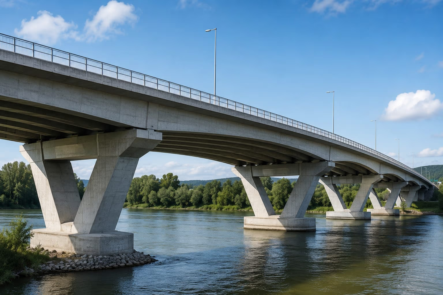
Infrastructure operators capture corridors with VisuraInfrastructure

Infrastructure operators

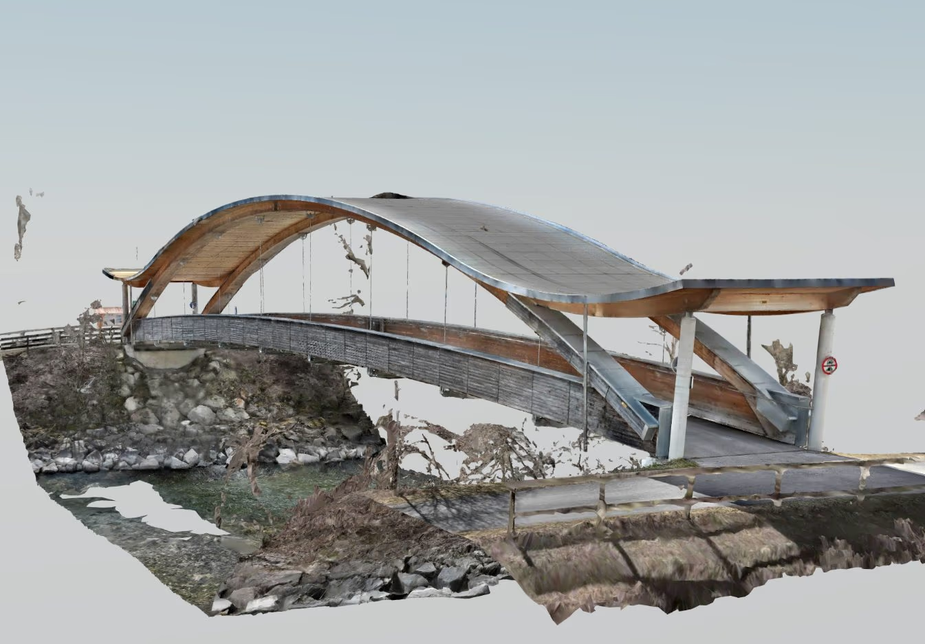
Capture bridges, roads and power line corridors digitally.

  • Output of classified point clouds
  • Automatically check critical clearances
  • Share results in the browser with all stakeholders
Construction companies document progress with VisuraConstruction

Construction companies

Document construction progress before the next invoice goes out.

  • 3D models & orthophotos for progress tracking
  • Check measurements directly in the browser
  • Multiple sites in one dashboard
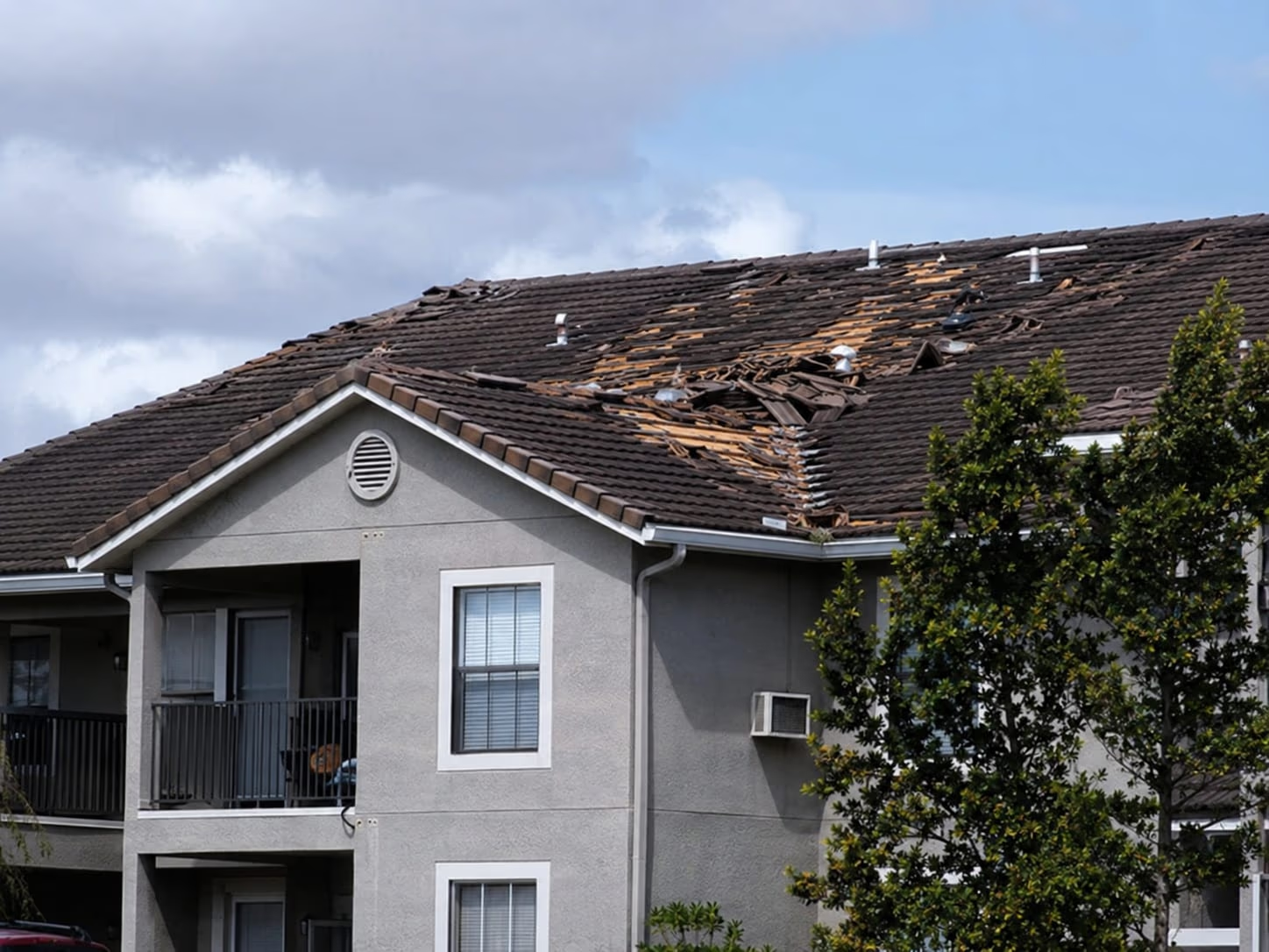
Tradespeople capture roofs and facades with VisuraTrades

Roofers, Facades & Trades

Capture roofs and facades — no scaffolding needed.

  • Document condition in the 3D model
  • Quotes and billing based on consistent measurements
  • Fewer site visits, more planning certainty
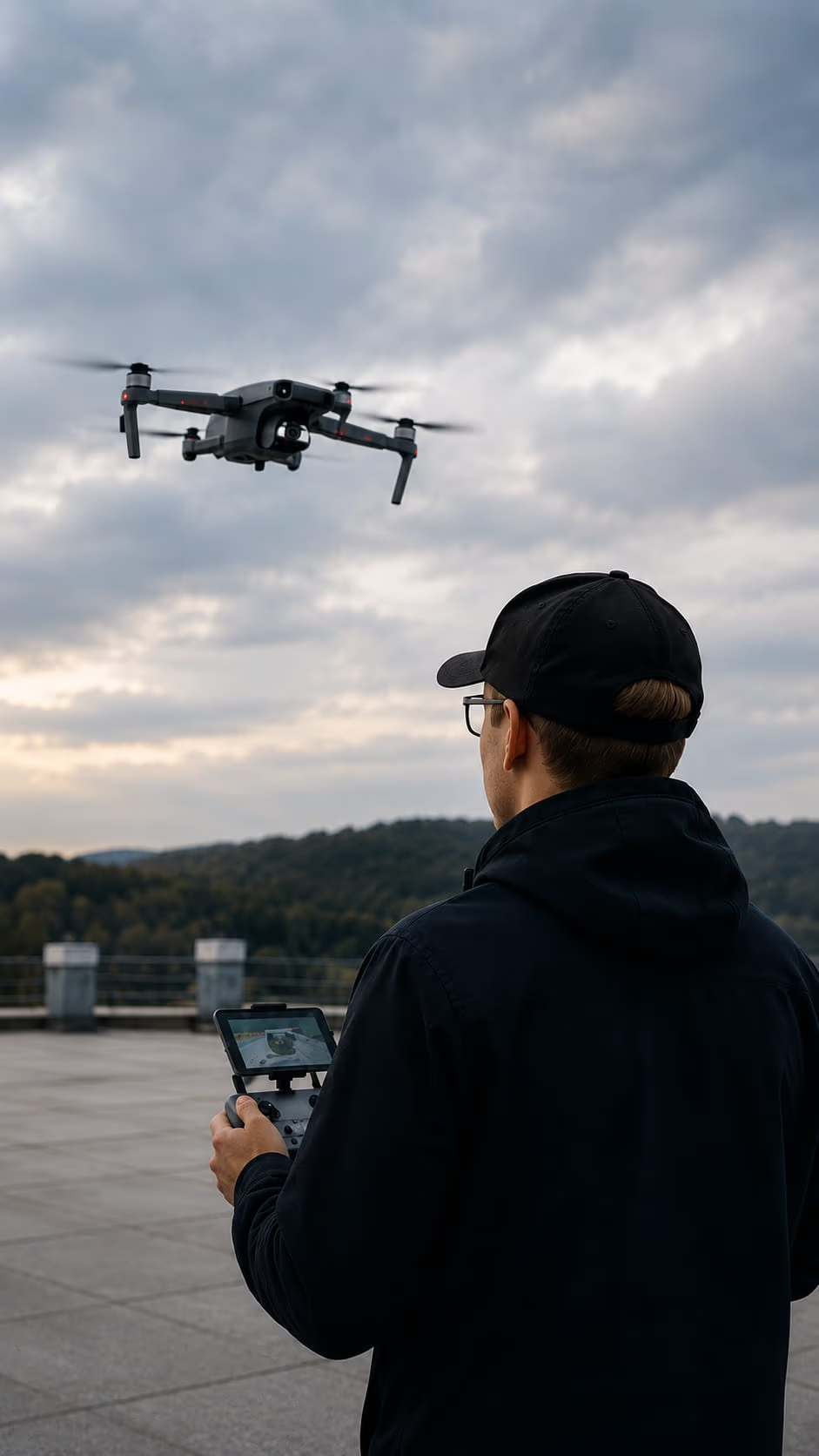
Drone service providers process client data with VisuraDrone services

Drone service providers

Process client data and share results instantly.

  • 3D models, point clouds & ortho viewer for any application
  • Scale without per-user licenses
  • Own or imported data in the same workflow
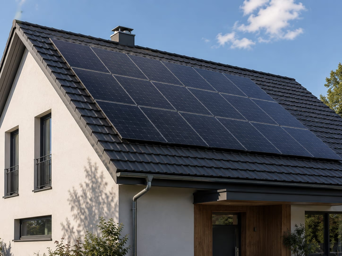
Solar planners assess PV potential with VisuraSolar

Solar planners

Assess solar potential directly from drone imagery.

  • 3D models for PV planning
  • Export to common PV planning software
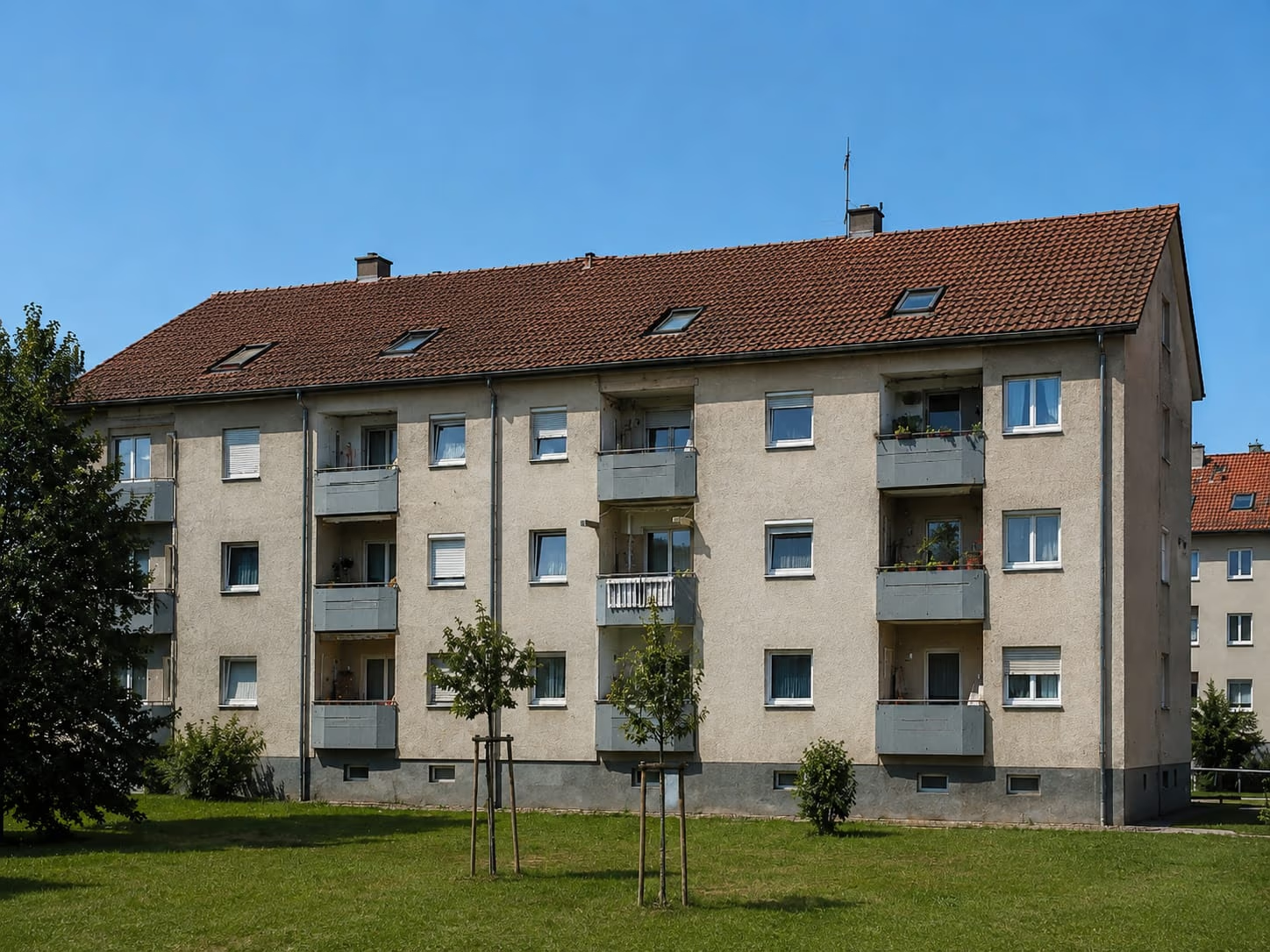
Property managers capture buildings digitally with VisuraProperty management

Property managers

Digitally capture buildings without endless site visits.

  • Coordinate renovations directly in the 3D model
  • Consistent measurements available for every trade
  • Condition viewable in the browser at any time
Insurers document damage with VisuraInsurance

Insurance

Damage documentation and asset assessment on a consistent data basis.

  • Document damage in the 3D model
  • Export area and condition data for expert reports
  • Before-and-after comparisons for claims handling
From the field

Three projects, one dashboard.

Selected references where drone surveying, laser scanning and Visura were used together.

Residential complex as a 3D model with roof surveyProperty management

Residential complex: renovation without endless site visits

Situation

Multiple buildings needed capturing for renovation — without endless on-site visits for every trade.

Outcome

Measurements, areas and condition checked in the browser. Quotes calculated on consistent figures — far fewer site visits.
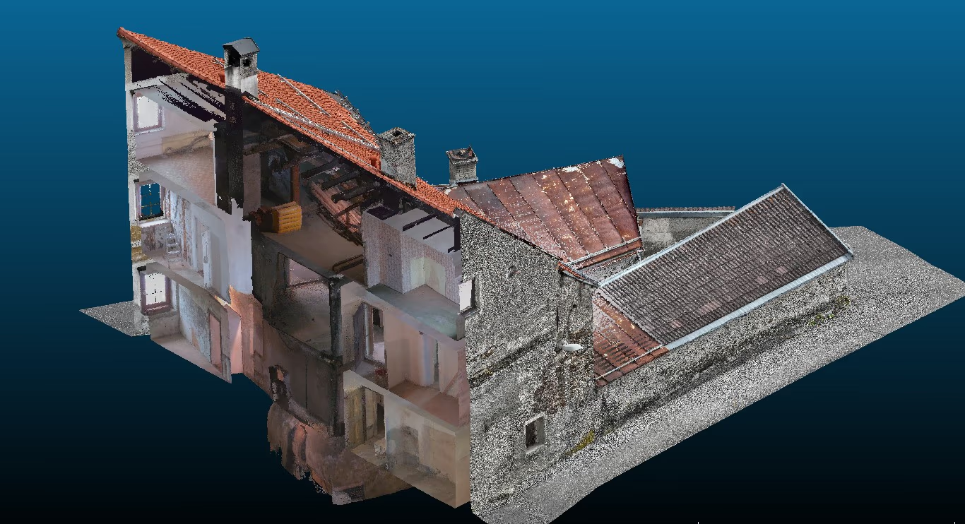
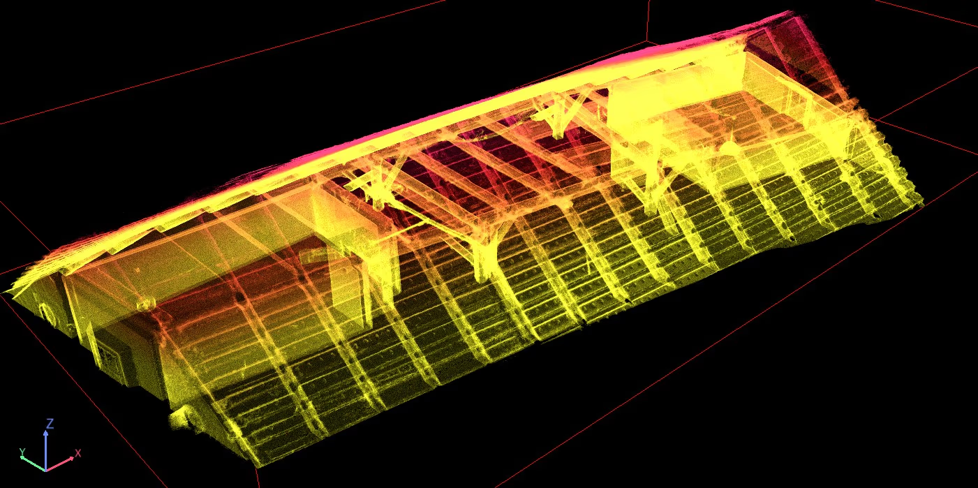
Listed building captured as a point cloudHeritage building

Listed building with no existing plans

Situation

Classic plan documents were missing or incomplete, many areas hard to access.

Outcome

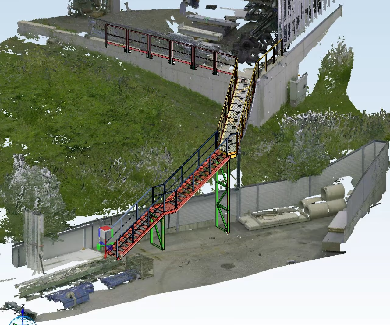
Continuous point cloud inside & outside plus digital twin — measurements directly in the browser.

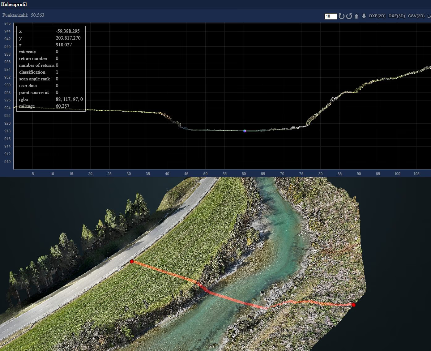
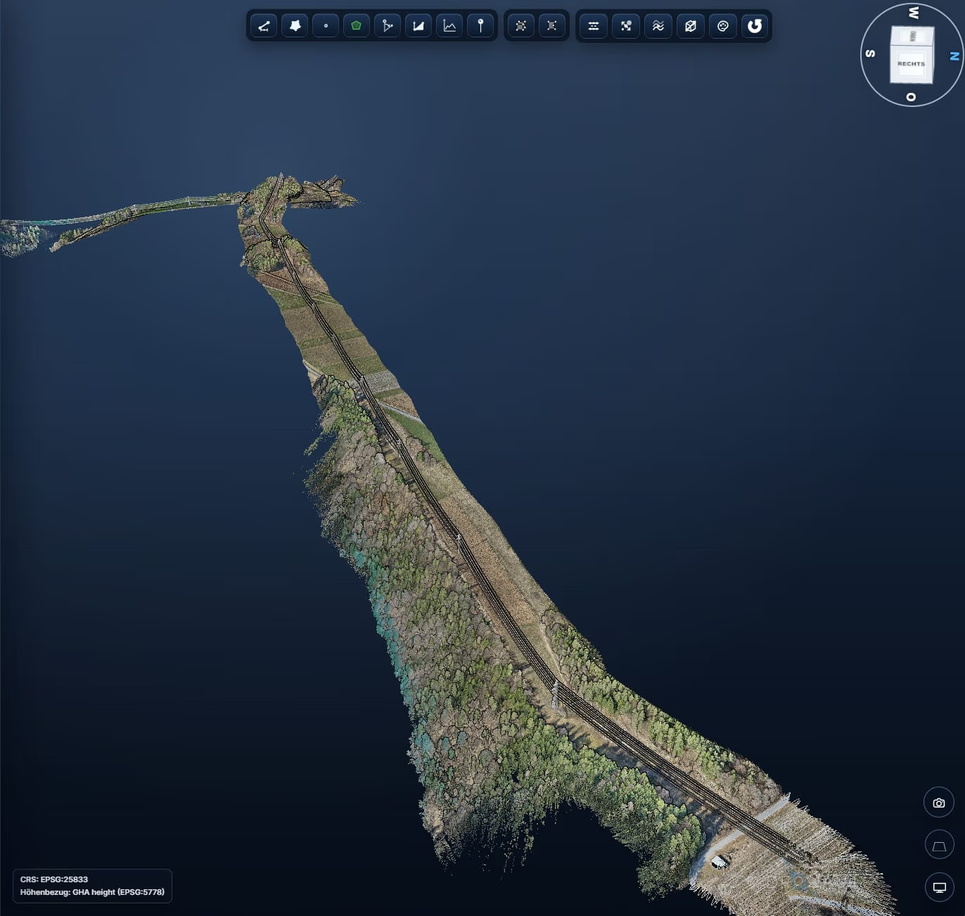
Power line corridor as a georeferenced point cloudInfrastructure

Power line corridor without terrain data

Situation

Planned corridor renovation — no terrain data existed for the conversion.

Outcome

Georeferenced point cloud, measurable in the browser for all stakeholders.

Pricing

Transparent and scalable.

No per-user pricing. Billed by usage, not by licenses.

Foundation for everything

Entry-level · all industries

Visura Core

€1,490/ year
  • Web platform with unlimited users
  • 5,000 images + 250 GB storage included
  • All viewers instantly available — no add-on required
  • Project dashboard & versioning
  • Structured delivery with access rights
Buy now
Packages

Bundled instead of piecing it together.

Two pre-configured bundles for the most common use cases.

Custom configuration and enterprise terms on request.

Roofers · Facade · Surveyors

Inspection Bundle

€1,990/ year

saves 20% vs. booking separately (€2,480)

  • Everything in Visura Core
  • 3D Model Workflow included
  • 5,000 images + 250 GB storage included
Buy now
Popular

Surveyors · Drone services · Construction

Surveying Bundle

€2,490/ year

saves 28% vs. booking separately (€3,460)

  • Everything in Visura Core
  • 3D Model, Point Cloud & Ortho workflows
  • 5,000 images + 250 GB storage included
Buy now

Large teams · custom requirements

Enterprise or custom solution

Price on request
  • Whether large enterprise or solo operator — we find the right solution.
  • Pay per use — individual projects welcome.
Get in touch

Add-ons can also be booked individually at any time

  • 3D Model Workflow

    OBJ/GLB/B3DM from imagery — downloadable and usable directly in the Core viewer.

    €990 / year
  • Point Cloud Workflow

    E57/LAS/LAZ/PLY from imagery — downloadable and ready for the Core viewer.

    €590 / year
  • Ortho Workflow

    GeoTIFF generation from imagery — ready to use in the Core viewer.

    €390 / year
  • Solar Modeling

    PV-Sol models, export to PV*SOL, Polysun and Helios 3D.

    €790 / year
  • Gaussian Splatting

    Photorealistic 3D captures, fluid in-browser navigation.

    €990 / year
Usage

Pre-paid packages · volume discount up to 25%

Image processing and storage beyond your quota at package rates instead of list price (€0.02/image · €1.80/GB/year).

Image package 10,000 images

€175€200
-12.5%

Image package 50,000 images

€750€1,000
-25%

Storage 500 GB

€750€900
-16.7%

Storage 1 TB

€1,350€1,800
-25%

Pre-paid packages are invoiced at purchase and offset against ongoing usage. Included quotas expire annually.

All prices are net prices.

Order

Order now.

Fill in the form and we'll prepare your invoice.

No automatic payment — we'll personally confirm.

Additional add-ons (optional, multiple selection possible)
Pre-paid packages (optional)
Usage pay-per-use (optional)

Your order is sent directly to us. It only becomes binding once we send you an order confirmation and invoice.

14 days. All modules. No credit card.

Try Visura with real projects — 50 GB test storage and 500 images included.

Start for free now
  • No credit card
  • All modules included
  • 50 GB test storage + 500 images
  • German-language support
FAQ

Frequently asked questions

Visura is the browser-based software platform by Dronautix: modelling, dashboard, 3D viewer, point cloud viewer and ortho viewer — view, measure and share directly in the browser, no installation required.

No. A web browser is all you need to use Visura and the Core viewers. Models are simply uploaded. However, if Visura should handle model creation for you, drone imagery is required.

Yes. Simply choose the add-on for processing your data: the 3D model workflow for 3D models, the point cloud workflow for point clouds and the ortho workflow for orthophotos. Your generated models are instantly ready to use in the Visura Core viewers.

Yes. We support data import — the common formats from DJI Terra, Pix4D, Agisoft & co. are covered. Mesh data as OBJ, GLB or B3DM, point clouds as LAS, LAZ and E57, and TIFF files for the ortho viewer.

Data import and availability in the Core viewers is usually completed within one to two hours. Processing of imagery and model generation depends on the number of images, but is completed within 48 hours at the latest.

No. The Core viewers are designed to be so simple and intuitive that anyone can start measuring right away. Your personal dashboard also includes a help center with tutorial videos explaining every function step by step.

Only you and the people you grant access to. There is no user limit per project. Each user is protected by personal login credentials.

Choose your package in the order form and submit it. We get back to you within 24 hours. The order only becomes binding once we send you an order confirmation and invoice.

Yes — request a demo or a 14-day trial access via the contact form.

Packages are billed annually; pay-per-use options are billed as consumed. All prices are net. Details can be found in our terms & conditions.

Contact

Book a demo or trial access.

We'll get back to you within 1–2 business days.

We respond within 1–2 business days. No spam.

Direct contact

Powered by

Dronautix&3DIT — 3D Interaction Technologies

We only use technically necessary cookies to run this site. Details in our privacy policy.